School of Natural Resources and Management
Department of Geoinformatics

Profile of Faculty

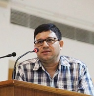
Prof. Arvind Chandra Pandey

Professor,
Department of Geoinformatics


Cell : +91-9955492100
E-Mail : arvindchandrap@yahoo.com/arvind.pandey@cuj.ac.in

Educational Qualification  
  1. Ph.D.  in Himalayan Geology (Remote Sensing)
  2. M.Sc. (Applied Geology),
  3. PGD-Remote Sensing & GIS
Awards/ recognition  
  1. Received NASA SERVIR (USA) Visiting fellowship, ( 2013)
  2. Teacher Training in Malaysian University, Terranganu (2017)
  3. Best Environmentalist Award (Environment & Social Welfare Society Khajuraho (M.P) February 2020.
Area of Interest   Water Resource Management, groundwater targeting, Arsenic and fluoride contamination, Land degradation & Waterlogging, Glacier studies in Himalayas, Natural hazards Assessment (Forest Fire, Drought, landslides and floods), Urban environment, Forest and climate change
Courses Taught   Geoinformatics applications in Geosciences, Water Resource & Hydrology, Natural Resource Management, Photogrammetry and Image Interpretation, Disaster Management, Cryosphere studies
Brief introduction   Prof. A. C. Pandey is Professor since 2013, in the Department of Geoinformatics, Central University of Jharkhand (CUJ), Ranchi. He previously served as Associate Professor (Remote Sensing) in Birla Institute of Technology, Mesra, Ranchi, for a decade and as Scientist in Department of Science & Technology, GoH, Chandigarh, for seven years. He acquired Ph.D. degree in Geology from Department of Geology, University of Delhi in 2001. He has been working in diverse areas of Geoinformatics Applications in Earth Sciences viz., Water Resources, Glaciology, Natural hazards, Urban Environment, Forest & Wildlife etc. He has 09 Ph.D. and 40 M.Tech/M.Sc. thesis completed under his guidance.
He has 09 Ph.D. and 50 M.Tech/M.Sc. thesis completed under his guidance. He has more than 90 publications in refereed international/national journals/Book Chapters and 02 edited books to his credit. He is recipient of NASA-SERVIR Fellowship in 2013 to work on Himalayan glaciers in Zanskar Valley, J&K. He was associated with many national projects as PI and Co-PI from ISRO, CGWB, DST and MoEF on aspects of Himalayan Glacier Study, Kosi Flood, Arsenic contamination, NUIS, Groundwater Targeting etc. His present research work focuses on water resources, forest fire, Himalayan cryosphere, Coastal studies, Flood Disaster in Gangetic Plains & Kashmir Valley,  Drought vulnerability in Bihar and Jharkhand State and Gangetic Plain etc. He is currently involved as PI and Co-PI in various R & D projects funded by Space Application Centre (SAC), ISRO related with Airborne Hyperspectral Sensing (AVIRIS-NG) for vegetation monitoring and NASA-ISRO, NISAR for flood monitoring and Base metal Mineralization and GISAT for Forest bio-physical and bio-chemical parameter assessment.
Administrative responsibilities (with active period)  
  1. Dean SNRM, (31st Jan.2014- 25th April 2017)
  2. Head DGI, (31st Jan. 2014 – 21st Dec. 2020)
  3. Registrar I/C (29th June 2016 to 19th Sept. 2016
Additional role/ responsibility  
  1. Superintendent, Exam, CUJ, 2014
  2. Superintendent CUCET, CUJ, 2017
  3. Chairman, National Institutional Ranking Framework (NIRF-CUJ) 2018-19.
  4. Member, CAS Committee, CUJ (2018-19)
  5. Dy. Superintendent CUCET, CUJ, 2019
  6. Coordinator EDUSAT (CUJ) 2013- Till date
  7. Coordinator Unnat Bharat Mission (CUJ) 2018- Till date
  8. Founder President Indian Society of Geomatics (ISG)-Ranchi Chapter 2016 -Till date
Ph.D. Supervision  

09 (Completed):

  1. Suraj Kumar Singh: Evaluation of Geo-hydrological Constraints on Flood and Waterlogging Hazards in Parts of North Bihar, India Using Geoinformatics (2008-2012)
  2. Amit Kumar : Assessment and comparative assessment of urban environment of Ranchi Township (2008-2013)
  3. Swagata Ghosh: Assessment of glacier dynamics in parts of Great Himalayan Range, Ladhak (India) using Geoinformatics (2009-2013)
  4. Anamika Shalini Tirkey: Watershed Prioritization under Changing Climatic conditions in Drought Prone Regions of Jharkhand State using Geoinformatics (2010-2019)
  5. Shashank Shekhar: Water Resource Assessment with Spatial Emphasis on Fluoride Contamination in Hard Rock Terrain (Palamu and Garhwa District, Jharkhand, India) using Remote Sensing and GIS Techniques (2009-2019)
  6. Basheer Ahammed KK: Analyzing Spatio Temporal Dynamics of Coastline and Socio Physical Vulnerability under Climate Change and Extreme Events in Eastern Coast of India (2015-2020)
  7. Tauseef Ahmad: Geoinformatics based flood hazard and risk assessment in Kashmir Valley (Jammu & Kashmir, India) (2014-2021)
  8. Binita Kumari: Spatio-Temporal Assessment of Forest Transformation in Palamau Tiger Reserve (India) using Geoinformatics (2013-2021)
  9. Saurabh Gupta : Forest change and fragmentation analysis using advanced geospatial techniques in Hazaribagh wildlife Sanctuary, Jharkhand, India (2013-2021)

05 (Ongoing):

  1. Mr. Satendra Chaudhary (2015). Spatio Temporal Evaluation of forest stress through forest fire and forest fragmentation studies with focus on elephant corridor and wildlife habitat,
  2. Ms. Stuti (2015). Water Resource Assessment and Drought Hazard and Risk Prognosis in a part of Koel Basin Jharkhand, (India) by using Geoinformatics Technologies.
  3. Mr. Guarav Tripathi (2016). Flood Inundation Characterization through Remote Sensing for Flood Risk Mapping and Monitoring in parts of North Bihar region, India
  4. Mr. Shahbaz Ahmad (2018). Estimating Primary Productivity, Forest health and  Above Ground Biomass Using Remote Sensing Techniques over Parambikulam Tiger Reserve ,Kerala.
  5. Ms Kavita Kaushik (2021). Flood and drought hazard vulnerability and risk assessment in context to climate change in Ganga-Brahamaputra valley using Geoinformatics.
Research Supervision  
  • M.Tech Dissertation (one year): 40
  • M.Sc. Dissertation (six months): 20
  • B.Tech Project (six months): 30
Collaboration   Space Application Centre (SAC) ISRO
Articles Published/Accepted  

Year wise: Projects details, Research publications etc.

Projects (Completed)

  1. A.C. Pandey (PI), Amit Kumar (Co-PI).  “Retrieval of Biophysical Parameters and Estimation of Gross Primary Productivity in Indian Forests Using GISAT over Dalma, Jharkhand” Duration 3 years (2017-2020); Rs. 22.40. Lakhs, SAC-ISRO.
  2. A.C. Pandey (PI), and Amit Kumar (Co-PI). “Evaluation of Forest Health and Forest Type Mapping of Sholayar Reserve Forest Using Hyperspectral AVIRIS-NG DATA” Duration 3 years (2018-2021); Rs. 23.00 Lakhs, SAC-ISRO.
  3. A.C. Pandey (PI), Amit Kumar (Co-PI) & C S Dwivedi (Co-PI). “Detailed Lithological Structural and Geomorphological Mapping and Modelling for Mineral Prognostication in Parts of Singhbhum Shear Zone, Jharkhand ,India Using Airborne L & S Bands SAR Images.” Duration 3 years (2018-2021); Rs. 25.24 Lakhs, SAC-ISRO.
  4. A.C. Pandey (Co-PI), Amit Kumar (PI), Parul Shrivastava (Co-PI), Purabi Saikia (Co-PI), and M. L. Khan(Co-PI). “Monitoring Spatio-Temporal Dynamics of Above Ground Biomass in Forest Ecosystems Using Airborne L & S Bands SAR Images in Hoshangabad, MP” Duration 3 years (2018-2021); Rs. 24.3 Lakhs SAC-ISRO.
  5. A.C. Pandey (Co-PI), Bikash Parida (PI), and A. Kumar (Co-PI). “Flood prognosis and inundation mapping using Airborne SAR (L bands) imags” Duration 3 years (2018-2021); Rs. 24.03 Lakhs, SAC-ISRO.
  6. A.C. Pandey (PI). “Mass Balance study in parts of Great Himalayan Range (J&K) with field Validation in Pensilungpa Glacier”. Duration 3 years ( 2010-2013), Rs 21.00 Lakhs,  DST, GOI.
  7. A.C. Pandey (Co-PI) & M S Nathawat (PI) “Land & Water Audit in Jharkhand State using Geoinformatics” Duration 6 years (2007- 2013); Rs. 36.00 Lakhs, UGC, New Delhi.
  8. A.C. Pandey (Co-PI) & M S Nathawat (PI).  “Geoinformatics Based Glacial Retreat and Mass Balance studies in Zanskar Valley, J&K Himalayas”. Duration 5 years (2007-2012) Rs. 27.00 Lakhs, Space Application Cenre (SAC), Ahmedabad.
  9. A.C. Pandey (CI), M S Nathawat (CI) & G Pathak (PI). “Water quality analysis in select blocks (10) of Garhwa and Palamu districts in Jharkhand State & its GIS database development.”  Duration 1 year (2006-2007), Rs 12.0 Lakhs, UNICEF (Bihar & Jharkahnd).
  10. A.C. Pandey (Co-PI) & M S Nathawat (PI). “Mapping Indicators of Desertification in Jaiselmer district, Rajasthan using satellite based Active SAR data.” Duration 1 year (2006-2007), Rs 8.0 Lakhs, Space Application Cenre (SAC), Ahmedabad.
  11. A.C. Pandey (Co-PI) & M S Nathawat (PI). “Desertification status mapping in NE parts of India using AWIFS data.” Duration 1 year (2005-2006), Rs 0.50 Laks + Satellite data cost, Space Application Cenre (SAC), Ahmedabad.
  12. A.C Pandey (Co-PI) “Wasteland mapping in select districts of Jharkhand using Remote Sensing”. Duration 1 year (2003-2004), Rs. 1.67 Lakhs, NRSA, DOS.
  13. A.C. Pandey (PI) & M S Nathawat (Co-PI). “Natural Resources Delineation and Creation of GIS database for Panchkula, Ambala and Y.nagar districts (Harayana) and Operationalisation of State NRDMS Centre”. Duration 4 years (2000-2004), 21.096 Lakhs, DST, GoI
  14. A.C. Pandey  (Co-PI), TVN Rao (PI) “Ground Water Targeting in Panchkula, Ambala, Yamunanagar, Rewari, Gurgaon, Mahendragarh, Faridabad districts of Haryana State”. Duration 2 years (1998-2000), Rs. 7.00 Lakhs, PWD Govt. of Haryana.

Patent: Nil

Research publications: 81
Articles in Journals (Published/ Accepted)


2021

  1. Basheer Ahammed, K. K., & Pandey, A. C. (2021) Characterization and impact assessment of super cyclonic storm AMPHAN in the Indian subcontinent through space borne observations Ocean & Coastal Management   E.Bv. 205(1). 105532 Doi: 10.1016/j.ocecoaman.2021.105532
  2. B.R. Parida, S. Bar, Gareth Roberts, SP. Mandal, AC. Pandey, Manoj Kumar, Jadunandan Dash (2021) Improvement in air quality and its impact on land surface temperature in major urban areas across India during the first lockdown of the pandemic Environment Research. https://doi.org/10.1016/j.envres.2021.111280.
  3. Tauseef Ahmad, Arvind Chandra Pandey and Amit Kumar  (2021) Long-term precipitation monitoring and its linkage with flood scenario in changing climate conditions in Kashmir valley, Geocarto International, DOI: 10.1080/10106049.2021.1923829 
  4. Shubham Bhattacharjee and Arvind Chandra Pandey       Contrasting behaviour of temporal glacier changes and long term estimation of glacier mass balance across Himalayan–Karakoram range Geocarto International DOI: 10.1080/10106049.2021.1923832
  5. Priya, T., Pandey, A.C. (2021) Geoinformatics-based assessment of land deformation and damage zonation for Gorkha earthquake, 2015, using SAR interferometry and ANN approach SN Appl. Sci.  3,573 https://doi.org/10.1007/s42452-021-04574-9.
  6. Dwivedi C., Raza R., Mitra D., Pandey A C., Jhariya D (2021) Groundwater Potential Zone Delineation in Hard Rock Terrain for Sustainable Groundwater Development and Management in South Madhya Pradesh, India. Geography, Environment, Sustainability 14(1):106-121 https://doi.org/10.24057/2071-9388-2020-195
  7. Kashyap, R., Pandey, A.C. & Parida, B.R (2021)             Spatio-temporal variability of monsoon precipitation and their effect on precipitation triggered landslides in relation to relief in Himalayas Spatial Information Research.https://doi.org/10.1007/s41324-021-00392-8
  8. B.R. Parida, G. Tripathi, A.C Pandey and A. Kumar (2021)          Estimating Floodwater depth using SAR-derived Flood inundation maps and Geomorphic model in Kosi River Basin (India) Geocarto International.    https://doi.org/10.1080/10106049.2021.1899298
  9. S.Bar, B.R. Parida, Gareth Roberts, A.C. Pandey, P. Acharya and J. Dash (2021) Spatio-temporal characterization of landscape fire in relation to anthropogenic activity and climatic variability over the Western Himalaya, India. GIScience & Remote Sensing 58(2), 281-299 DOI: 10.1080/15481603.2021.1879495.
  10. Ahmad, Shahbaz, Pandey, A.C., Kumar, A. Lele, N. & Bhattacharya, B (2021) Potential of hyperspectral AVIRIS-NG data for vegetation characterization, species spectral separability, and mapping Appl Geomat https://doi.org/10.1007/s12518-021-00355-6

2020

  1. B.R. Parida, S. Bar, N. Singh, B. Oinam, A.C Pandey, and M. Kumar (2020) A short-term decline in anthropogenic emission of CO2 in India due to COVID-19 confinement. Progress in Physical Geography: Earth and Environment, 1-17 DOI: 10.1177/0309133320966741
  2. B.R. Parida, A.C Pandey, and N.R Patel (2020) Greening and Browning Trends of Vegetation in India and Their Responses to Climatic and Non-Climatic Drivers. Climate, MDPI 8, 92, 1-29       
  3. S. Bar and B.R. Parida and A.C Pandey (2020)Landsat-8 and Sentinel-2 based Forest fire burn area mapping using machine learning algorithms on GEE cloud platform over Uttarakhand, Western Himalaya Remote Sensing Applications: Society and Environment (RSASE),  18, 100324, 1-11.  
  4. G. Tripathi, A.C Pandey, B.R. Parida and A. Kumar (2020). Flood inundation mapping and impact assessment using multi-temporal Optical and SAR satellite data: A case study of 2017 Flood  in Darbhanga district, Bihar, India Water Resources Management, 34 (6), 1871-1892.           
  5. Ahmad, S., Pandey, A.C., Kumar, Parida, B.R, A. Lele, N. & Bhattacharya, B.,( 2020) Chlorophyll deficiency (chlorosis) detection based on spectral shift and yellowness index using hyperspectral AVIRIS-NG data in Sholayar reserve forest, Kerala. Remote Sensing Applications: Society and Environment,   19, 2020, 100369, ISSN 2352-9385, https://doi.org/10.1016/j.rsase.2020.100369.                  
  6. Kishore, B.S.P.C., Kumar, Amit*, Saikia, P., Lele, N., Pandey, A.C., Srivastava, P., Bhattacharya, B.K., Khan, M.L.  (2020) Major Forests and Plant Species discrimination in Mudumalai Forests Region using Airborne Hyperspectral Sensing. Journal of Asia-Pacific Biodiversity 1-15.
  7. Kumar, Amit, Pandey, A.C., Pandey, S., Srivastava, P (2020) Evaluating Long Term Variability in Precipitation and Temperature in Eastern Plateau Region, India and its impact on Urban Environment. Environment, Development and Sustainability DOI: 10.1007/s10668-020 00742-w
  8. Lal, P., Prakash, A., Kumar, Amit*, Srivastava, P.K., Srivastava, P., Saikia, P., Pandey, A.C., Khan, M.L.  (2020) Evaluating the 2018 Extreme Flood Hazard Events in Kerala, India Remote Sensing Letters 11(5)    436-445
  9. Ahmad, T., Pandey, A.C., Kumar, Amit (2020) Impact of 2014 Kashmir flood on land use/ land cover transformation in Dal Lake and its surroundings, Kashmir valley, SN Applied Sciences 2681
  10. Kumari, B., Pandey, A.C., Kumar, Amit (2020) Remote Sensing approach to evaluate anthropogenic influences on Forest Cover of Palamau Tiger Reserve, Eastern India Ecological Processes 9(17) 1-11
  11. Somnath Bar and B.R. Parida and A.C Pandey (2020) Landsat-8 and Sentinel-2 based Forest fire burn area mapping using machine learning algorithms on GEE cloud platform over Uttara khand, Western Himalaya. Remote Sensing Applications: Society and Environment (RSASE) 18, 100324 [ISSN: 2352-9385]   1-11     
  12. G. Tripathi, A.C Pandey, B.R. Parida and A. Kumar (2020). Flood inundation mapping and impact assessment using multi-temporal Optical and SAR satellite data: A case study of 2017 Flood  in Darbhanga district, Bihar, India Water Resources Management  34 (6)1871-1892
  13. Basheer Ahammed, K. K., & Pandey, A. C. (2020)Coastal Social Vulnerability and Risk Analysis for Cyclone Hazard along the Andhra Pradesh, East Coast of India KN Journal of Cartography and Geographic Information SN. 69(4). 285-303 Doi: 10.1007/s42489-019-00029-9
  14. J. Dash, M. D. Behera, C. Jeganathan, A. C. Pandey (2020) India’s contribution to mitigating the impacts of climate change through vegetation management         Tropical Ecology doi.org/10.1007/s42965-020-00075-9

2019

  1. Basheer Ahammed, K. K., & Pandey, A. C. (2019). Geoinformatics based Assessment of Coastal Multi- Hazard Vulnerability along the East Coast of India. Spatial Information Research          SN. 27(3). 295-307, Doi:10.1007/s41324-018-00236-y
  2. Ahmad, S., Pandey, A.C., Kumar, A., Lele, N.V., Bhattacharya, B.K. (2019) Forest health estimation in Sholayar Reserve Forest, Kerala using AVIRIS-NG hyperspectral data. Jour of Spatial Information Research
  3. Binita Kumari and Arvind Chandra Pandey (2019)MODIS based forest fire hotspot analysis and its relationship with climatic variables Jour of Spatial Information Research https://doi.org/10.1007/s41324-019-00275-z
  4. Chaudhary S and Pandey AC (2019) Multiple indices based drought analysis by using long term climatic variables over a part of koel river basin, India Spatial Information Research. 28 273-285
  5. Gupta, S.K., Pandey, A.C. (2019) Change detection of landscape connectivity arisen by forest transformation in Hazaribagh wildlife sanctuary, Jharkhand (India Spatial Information Research doi.org/10.1007/s41324-019-00301-0

2018

  1. Basheer Ahammed,K. K., & Pandey, A. C. (2018)Shoreline Morphology Changes along the Eastern Coast of India, Andhra Pradesh by Using Geospatial Technology Journal of Coastal Conservation     SN. 23(2).331-353         doi: 10.1007/s11852-018-0662-5
  2. A.P. Kushwaha, A.C. Pandey, S.S. Mahto. (2018) Assessment of Runoff Pattern and Relationship to Sediment Yield of Bhagirathi–Alaknanda River Basin Using Geospatial Techniques, Journal of Geo-visualization and Spatial Analysis.
  3. S.Kanga, A.C. Pandey, A.Shaheen, S.K.Singh (2018) Geospatial Modeling to Assess Human  Elephant Conflict and Corridor Mapping in Palamau Tiger Reserve, Jharkhand (INDIA) Jour. Future Engg Tech., vol 13, no. 3.
  4. Tauseef Ahmad, Arvind Chandra Pandey, Amit Kumar (2018) Flood hazard vulnerability assessment in Kashmir Valley, India using, geospatial approach Jour. Phy& Chem of the Earth

2017

  1. A.C. Pandey and Stuti (2017) Geospatial Technique for Runoff Estimation Based on SCS-CN Method in Upper South Koel River Basin of Jharkhand (India) International Journal of Hydrology Vol. 1, Issue 7                      
  2. Bikash Ranjan Parida , Sailesh N. Behera,  Oinam Bakimchandra, Arvind Chandra Pandey and Nilendu Singh (2017) Evaluation of Satellite-Derived Rainfall Estimates foran Extreme Rainfall Event over Uttarakhand, Western Himalayas Hydrology, 4, 22 doi:10.3390/hydrology4020022
  3. Anamika Shalini Tirkey, Mili Ghosh, A.C. Pandey, Shashank Shekhar (2017) Assessment of climate extremes and its long term spatial variability over the Jharkhand state of India The Egyptian Journal of Remote Sensing and Space Science http://dx.doi.org/10.1016/j.ejrs.2016.12.007
  4. Kumar A.K. and A.C. Pandey (2017) Analyzing recent seismic activities and risk in Nepal Himalayas using Geoinformatics Journal of Urban and Environmental Engineering 30375  
  5. Pooja Rana, Jeganathan Chockalingam and Arvind Chandra Pandey (2017) Space-Time Integrated Landslide Hazard Zonation near Tehri Dam in Uttarakhand, India: Integrated Landslide Hazard Zonation. Remote Sensing Techniques and GIS Applications in Earth and Environmental Studies DOI: 10.4018/978-1-5225-1814-3.ch007
  6. Tauseef Ahmad, A.C. Pandey and Amit Kumar (2017) Impact of Flooding on Land Use/ Land Cover in Wular  Lake and its Environs, Kashmir Valley, India, using Geoinformatics                        ISPRS Annals of the Photogrammetry, Remote Sensing and Spatial Information Sciences, 4th International GeoAdvances Workshop, 14–15, Safranbolu, Karabuk, Turkey

2016

  1. Kumar A.K. and A.C. Pandey (2016) Geoinformatics based Groundwater Potential Assessment in Hard Rock Terrain of Ranchi Urban Agglomeration, Jharkhand (India) using MCDM-AHP Techniques. Groundwater for Sustainable Development Elsevier 2-3: 27.41 DOI: 10.1016/j.gsd.2016.05.001
  2. Basheer Ahammed, K. K., Mahendra, R. S., & Pandey, A. C (2016) Coastal Vulnerability Assessment for Eastern Coast of India, Andhra Pradesh by Using Geo-Spatial Technique”. Geoinformatics & Geo-statistics: An Overview     SciTec. 4(3) doi: 10.4172/2327-4581.1000146
  3. Tirkey, A.S., Ghosh, M. and A.C Pandey (2016) Soil erosion assessment for developing suitable sites for artificial recharge of groundwater in drought prone region of Jharkhand state using geospatial techniques Arab J Geosci          9: 362 doi:10.1007/s12517-016-2391-0

2015

  1. Yaduvnshi, P.K. Srivastava and A.C. Pandey (2015) Integrating TRMM and MODIS satellite with socio-economic vulnerability for monitoring drought risk over a tropical region of India Physics and Chemistry of the Earth,Elsevier DOI: http://dx.doi.org/10.1016/j/pce.2015.01.006
  2. Fayma Mushtaq, Mili Ghosh, Nee Lala and A.C. Pandey (2015) Assessment of pollution level in a Himalayan Lake, Kashmir, using geomatics approach International Journal of Environmental Analytical Chemistry 95:11 1001-1013
  3. A.C. Pandey and A. Kumar (2015) Spatio-temporal variability of surface water quality of fresh water resources in Ranchi Urban Agglomeration, India using geospatial Techniques Applied Water Science   Vol. 5, Issue 1   pp. 13:26:  Springer Publication. DOI: 10.1007/s13201-014-0165-y

2014

  1. Swagata Ghosh, Arvind C. Pandey and Mahendra S. Nathawa t(2014) Mapping of debriscoveredglaciers in parts of the Greater Himalaya Range, Ladakh, western Himalaya, usingremote sensing and GIS. Journal of Applied Remote Sensing 8(1), 083579 DOI:10.1117/1.JRS.8.083579    
  2. Swagata Ghosh, A.C. Pandey, M.S. Nathawat, I M Bahuguna, Ajai (2014) Contrasting signals of glacier changes in Zanskar valley, Jammu & Kashmir, India using Remote Sensing and GIS Journal of the Indian Society of Remote Sensing 42 (4) 817-827
  3. Shashank Shekhara and A.C. Pandey (2014) Delineation of groundwater potential zone in hard rock terrain ofIndia using remote sensing, geographical information system (GIS)and analytic hierarchy process (AHP) techniques Geocarto International http://dx.doi.org/10.1080/10106049.2014.894584
  4. A.C. Pandey and Amit Kumar (2014) Spatio-temporal variability of surface water quality of fresh water resources in Ranchi Urban Agglomeration, India using geospatial Techniques Water Sci. DOI 10.1007/s13201-014-0165-y
  5. Shashank Shekhar , A.C.Pandey, Anamika Shalini Tirkey (2014) A GIS-based DRASTIC model for assessing groundwater vulnerability in hard rock granitic aquifer Arab J Geosci DOI 10.1007/s12517-014-1285-2
  6. Suraj Kumar Singh, A.C. Pandey, V.S. Rathore and M.S. Nathawat (2014) Evaluating factors responsible for contrastic signature of wasteland development in northern & southern Ganga plains (Bihar State, India) with focus on waterlogging Arabian Journal of Geosciences DOI 10.1007/s12517-013-1094-zSpringer

2013

  1. Fayma Mushtaq and A. C. Pandey (2013) Assessment of land use/land cover dynamics vis-à-vis hydrometeorological variability in Wular Lake environs, Kashmir Valley, India using multitemporal satellite data        . Arab J Geosci DOI 10.1007/s12517-013-1092-1
  2. A.C. Pandey  and Akshay Kumar            (2013) Analyzing topographical changes in open cast coal mining region of Patratu, Jharkhand using CARTOSAT- I Stereopair satellite images Geocarto International DOI: 10.1080/10106049.2013.838309
  3. Anamika Shalini Tirkey, A. C. Pandey and M. S. Nathawat (2013) Use of High Resolution Satellite Data, GIS and NRCS CN Technique for Estimation of Rainfall InducedRunoff in Small Catchment of Jharkhand India       Geocarto International DOI:10.1080/10106049.2013.841773
  4. Suraj Kumar Singh and A.C. Pandey (2013) Geomorphology and the controls of geohydrology on waterlogging in Gangetic Plains, North Bihar, India Environ Earth Sci DOI 10.1007/s12665-013-2562-1
  5. Amit Kumar and A.C. Pandey (2013) Spatio-temporal assessment of urban environmental conditions in Ranchi Township, India using remote sensing and Geographical Information System techniques International Journal of Urban Sciences http://dx.doi.org/10.1080/12265934.2013.766501
  6. Akshay Kumar and  A.C. Pandey            (2013) Evaluating Impact of Coal Mining Activity on Landuse/Landcover Using Temporal Satellite Images in South Karanpura Coalfields and Environs,Jharkhand State, India International Journal of Advanced Remote Sensing and GIS vol., 2, Issue 1  pp. 183-197
  7. S. Tirkey, A.C. Pandey and M.S. Nathawat (2013) Use of Satellite Data, GIS and RUSLE for Estimation of Average Annual Soil Loss in Daltonganj Watershed of Jharkhand (India) Journal of Remote Sensing Technology  vol. 1    PP. 20-30

2012

  1. A.S. Tirkey, A. C. Pandey and M. S. Nathawat (2012) Groundwater level and rainfall variability trend analysis using GIS in parts of Jharkhand state (India) for sustainable management of water resources International Research Journal of Environmental Sciences vol-1     24-31   
  2. Shashank Shekhar, A.C. Pandey and M.S. Nathawat (2012) Evaluation of Fluoride contamination in groundwater sources in hard rock terrain in Garhwa district, Jharkhand     Int. Journal of Environmental Sciences vol- 3 No. 3 1022-1030 DOI:10.6088/ijes.2012030133010
  3. A.C.Pandey, Amit Kumar and A.T. Jeyaseelan (2012) Urban Built-up Area Assessment of Ranchi Township using Cartosat-I Stereopairs Satellite Images Journal of Indian Society of Remote Sensing,Springer DOI 10.1007/s12524-012-0209-4
  4. A.C.Pandey, Shashank Shekhar, M.S. Nathawat (2012) Evaluation of Fluoride Contamination in Groundwater Sources in Palamu District, Jharkhand, India Journal of Applied Sciences, Science Alert 12(9) 882-887
  5. Swati Pandey, A.C.Pandey, Manoj Kumar1, N.C. Mahanti1 and M.S. Nathawat (2012) Drought Hazard Assessment Using Geoinformatics over parts of Chotanagpur Plateau region, Jharkhand, India Natural Hazards           DOI: 10.1007/s11069-012-0093-9
  6. A.C.Pandey, Suraj Kumar Singh, M.S. Nathawat, Dipankar Saha (2012) Assessment of surface and subsurface waterlogging, water level fluctuations, and lithological variations for evaluating groundwater resources in Ganga Plains  International Journal of Digital Earth pp. 1-21DOI: 10.1080/17538947.2011.624644
  7. Amit Kumar, A. C. Pandey, A.T. Jeyaseelan (2012) Built-up and vegetation extraction and density mapping using World View-II. Geocarto International DOI: 10.1080/10106049.2012.657695
  8. A.C. Pandey, Nathawat M.S and Ghosh, Swagata  (2012) Glacier Morphometric Control on Glacier area changes in Great Himalayan Range, Jammu & Kashmir, India Current Science

2011

  1. A.C. Pandey, Swagata Ghosh, M.S.Nathawat and Reet Kamal Tiwari (2011) Area Change and Thickness Variation over Pensilungpa Glacier (J&K) using Remote Sensing Journal of the Indian Society of Remote Sensing, Springer DOI 10.1007/s12524-011-0134-y
  2. A.C. Pandey, Ghosh, Swagata and Nathawat, M.S. (2011) Evaluating patterns of temporal glacier changes in Greater Himalayan Range, Jammu & Kashmir, India Geocarto International            26 (4) 321-338 DOI: 10.1080/10106049.2011.554611
  3. Amit Kumar, A.C. Pandey, NajmulHoda and A.T. Jeyaseelan (2011) Evaluation of Urban Sprawl Pattern in Tribal Dominated Cities of Jharkhand State, India International Journal of Remote Sensing, Taylor and Francis 32(22) 7651-7675 DOI: 10.1080/01431161.2010.527391
  4. Amit Kumar, A.C. Pandey, NajmulHoda and A.T. Jeyaseelan (2011) Evaluating the Long-term Urban Expansion of Ranchi Township, India using Geospatial Technology Journal of Indian Society of Remote Sensing, Springer      39(2) 213-224 DOI: 10.1007/s12524-011-0089-z
  5. Ghosh Swagata, A.C.Pandey Nathawat M.S., Bahuaguna I.M., and Ajai (2011) Evaluating geological and geomorphological control on changes in Higher Himalayan Range, Jammu and Kashmir, India Journal of Geomatics Vol.5   No.279- 84

2010

  1. Nathawat M.S., Rathore V.S., A.C Pandey, Singh S. K. and Ravishankar G (2010) Monitoring & analysis of wastelands and its dynamics using multi-resolution and temporal satellite data in part of Indian state of Bihar International journal of Geomatics and Geosciences   1 (3)            297-307
  2. Singh S. K., A.C. Pandey and Nathawat M.S. (2010) Rainfall Variability and Spatio Temporal Dynamics of Flood Inundation during the 2008 Kosi Flood in Bihar State, India Asian Journal of Earth Sciences 4:9-19           
  3. A.C. Pandey, Singh S. K., and Nathawat M.S. (2010) Waterlogging and flood hazards vulnerability and risk assessment in Indo- Gangetic plain Natural Hazards 55 273-289
  4. A.C. Pandey, Singh S. K. and Nathawat, M.S. (2010) Analyzing the impact of anthropogenic activities on waterlogging dynamics in Indo-Gangetic plains, Northern Bihar, India International Journal of Remote Sensing vol. 33no-1 135-149

2009

  1. Rai P.K., Nathawat M.S. and A.C. Pandey. (2009) Glacier Domain Mapping through Image Processing Techniques in Doda Valley, Zanskar Basin, Ladhak, J&K National Geographic Journal of India Vol.55(2) 47-52
  2. Rai P.K., Nathawat M.S.,  A.C. Pandey and Raju K.N. (2009) Morphometric Characteristics of Glaciers in Doda Valley, Zanskar basin, J&K Trans. Inst. Indian Geographers        Vol.31 (2) 136-.141
  3. Mondal S, A.C.Pandey and Garg R.D (2009) Hydrogeomorphological mapping for Groundwater prospect evaluation using multi-temporal satellite images in a part of Lower Garhwal Himalayas Journal of Indian Society of Remote Sensing (JISRS) vol. 36 pp.69-76

2005

  1. Dubey C. S. Chaudhary M, Sharma B.K, A. C Pandey and Singh B          (2005) Visualization of 3D digital elevation model for landslide assessment and prediction in mountainous terrain- a case study of Chandmari Landslide, Sikkim, Eastern Himalaya  Geosciences Journal 9 (4) pp 363-373
  2. A.C, Pandey (2005) Morphotectonic Evolution of Bhagirathi Valley, Lesser Garhwal Himalaya, Uttaranchal Indian Journal of Geomorphology vol. 9 (1&2) pp 73-82

Books and Book Chapters (Published/ Accepted)

  1. A.C Pandey, B.R. Parida, S. Bhattacharjee, T. Priya, Wasim, M. Salim, R Kashyap (2021). Factors associated with COVID-19 and predictive modelling of spread across five urban metropolises in the world. Computation Intelligence Approaches for combating COVID-19, edited by S Kautish, SL Peng, and AJ Obaid in Springer International Publishing, ISBN: 9783030689353.
  2. Tripathi G, A.C Pandey, B.R. Parida, and A. Shakya (2020). Comparative Flood Inundation Mapping Utilizing Multi-Temporal Optical and SAR Satellite Data Over North Bihar Region: A Case Study of 2019 Flooding Event Over North Bihar (Chapter 8, pages 149-168), in Spatial Information Science for Natural Resource Management. DOI: 10.4018/978-1-7998-5027-4
  3. Basheer Ahammed,K. K., & Pandey, A. C. (2021) Geo Spatial Application for Coastal Morphology Changes along the Sand Mining Coast: Case Study on Alappad, Kerala Geophysical Monograph. John Wiley and Sons Ltd: Hoboken, United States, PP 33-46. ISBN: 978-1-119-35918-0 (hard cover), 978-1-119-35919-7 (e-book)
  4. Amit Kumar, Diksha, A.C. Pandey, and M. L. Khan (2020) Urban Risk and Resilience to Climate Change and Natural Hazards: A Perspective from a Million‐Plus Cities from the Indian Subcontinent. In: Advanced Techniques for Disaster Risk Management and Mitigation Geophysical Monograph. John Wiley and Sons Ltd: Hoboken, United States, PP 33-46. ISBN: 978-1-119-35918-0 (hard cover), 978-1-119-35919-7 (e-book)
  5. Stuti, A.C. Pandey, and S.K. Gupta (2019) Ground water Prospect Mapping in Upper South Koel River Basin Jharkhand (India) based on GIS and Remote Sensing Technology. Water and Waste Water Management and Modeling Apple Academic Press, 459-479. ISBN: 177188746X/ 9781771887465
  6. S.K. Gupta, A.C. Pandey, Stuti (2019) Geoprocessing based hydrological sensitivity analysis and its impact on forest and terrain attributes in Hazaribagh wildlife sanctuary Apple Academic Press 481-495. ISBN: 177188746X/ 9781771887465
  7. A.C. Pandey, Saklani, P.S. and Chandra S. Dubey          (2005) Geological and Morphotectonic Studies Using Satellite Images of Tehri-Uttarkashi district, Lesser Garhwal Himalaya Geological Aspect       Satish Serial Publishing House, Delhi volume-3 pp 153-171
  8. A.C. Pandey (2005) Waiting for inevitable natural disaster in Lesser Himalayas, Garhwal - A Geoinformatics based geo-environmental perspective on feasibility of Tehri dam   Disaster Management. Narosa Publishing House, Delhi pp 152-1602002
  9. A.C. Pandey and Nathawat M.S. (2002) Hydro geomorphological Mapping Using Remote Sensing Techniques for Locating Ground Water Prospect Zones in Panchkula District, Haryana GIS Development Vol. 6 (5)      31-34
  10. Kumar, A.K. Rai and A.C. Pandey (2016) Geoinformatics based Site Suitability Modeling for Future Urban Development using MCDM- Analytic Hierarchy Process Techniques. In Remote Sensing for Natural Resources Management & Monitoring Scientific Publishers, India
Seminar/ Workshop/ Conference Participation  
  1. Shahbaz Ahmad and A C Pandey (2021) Hyperspectral remote sensing for synergetic applications in qualitative and quantitative assessment of vegetation parameters”. National Conference on “Recent Trends in geospatial Technology in Earth Resource Mapping: Issues and Challenges” on 20th March, 2021 organized by Department of Geoinformatics, Central University of Jharkhand.
  2. Shahbaz Ahmad and A C Pandey (2020).” Techniques in Hyperspectral Data Analysis and Processing”. 2nd National Workshop Organized by IESD, BHU, Varanasi during 27th -31st January 2020.
  3. A.C. Pandey, T Ahmad & Amit Kumar  (2017) Flood vulnerability and risk assessment vis-à-vis Urban-Rural built-up development in Kashmir Valley (J&K), India using Geoinformatics. Paper Presented at  38th Asian Conference on Remote Sensing (ACRS) 38th Asian Conference on Remote Sensing (ACRS)
  4. B.R. Parida, A.C Pandey, and N.R Patel (2020). Spatial-temporal Patterns of vegetation trends and Responses from Climate and Non-climate Factors. National Symposium on Remote Sensing for Envioronment Monitoring & Climate Change Assessment: Opportunities and Challenges, 18-19 December, 2020 SAC Ahmedabad, India.
  5. G. Tripathi, A.C Pandey, B.R. Parida (2020). Spatıo-temporal Analysıs of Turbıdıty in Ganga Rıver in Patna, Bıhar Usıng Sentınel-2 Satellıte data lınked wıth Covıd-19 Pandemıc. IEEE International India Geoscience and Remote Sensing Symposium, 2-4 December, 2020 Ahmedabad, India.
  6. Stuti Chaudhary, Arvind Chandra Pandey (2020). Runoff estimation vis-à-vis drought vulnerability analysis using geoinformatics in part of Koel river basin, Jharkhand (India). National Conference on Challenges in Earth System Sciences for Global Sustainability (CESS-GS) January 15-17, 2020. CORAL IIT Kharagpur, India.
  7. G Tripathi, A C Pandey, B R Parida (2019) “Comparative flood area analysis utilizing VV and VH polarizations Sentinel-1A SAR data”. National symposium on Innovations in geospatial technology for sustainable development with special emphasis on NER during 20-22nd November, 2019 at North Eastern Space Application Centre, Umiam, Meghalaya.
  8. KK Basheer Ahammed, Arvind Chandra Pandey (2019). “Impact of Marine Sand Mining on Coastal Morphology: A Case Study on Alappad Coast, Kerala” Sixth Biennial Conference OSICON-19 Indian Ocean Processes and Resources – A Key to Blue Economy ” 275-276. CMLRE-MoES, Kochi on 12th – 14th Dec 2019
  9. KK Basheer Ahammed, Arvind Chandra Pandey (2018) “Coastal Social Vulnerability analysis for Cyclone along the Coastal Andhra Pradesh” Environmental Challenges and Sustainability (ICECS) 85-86. Central University of Jharkhand Ranchi on 31st Oct -2nd Now 2018
  10. Stuti Chaudhary, Arvind Chandra Pandey (2018) Ground water Prospect Mapping in Upper South Koel River Basin Jharkhand (India) based on GIS and Remote Sensing Technologies. International Conference on Water and waste water management and modeling, 16-17 January, 2018 Central University of Jharkhand, India.
  11. S. K. Gupta, A. C Pandey (2018) Cluster Techniques to threshold Vegetation Indices & Gap Detection in Hazaribagh Wildlife Sanctuary, Jharkhand (India)”in February 09-11-2018 at Center for climate Change &Water Research, SGVU, Jaipur (Challenge & solution for a sustainable Environment).
  12. A.C. Pandey, T Ahmad & Amit Kumar (2017) Flood vulnerability and risk assessment vis-à-vis Urban-Rural built-up development in Kashmir Valley (J&K), India using Geoinformatics. Paper Presented at 38th Asian Conference on Remote Sensing (ACRS) 38th Asian Conference on Remote Sensing (ACRS).
  13. KK Basheer Ahammed, Arvind Chandra Pandey (2016) “Assessment of shoreline changes along Andhra coast using geospatial techniques”. Climate, Recent Findings and Future Challenges. 89-90/ CSIR- NIO, Goa on 27-30 April 2016
  14. S. K. Gupta, A. C Pandey (2016) “Utilizing Geo-informatics in mapping forest transformation” In Hazaribagh Wildlife Sanctuary, Jharkhand, India (National Seminar on Environmental and development in eastern India (Status, Issues and Challenges) at Ranchi University (17-18 DEC 2016).
Program Organized  
  1. One day workshop on the topic University Competition on Water Resources Management Consultative Workshop” conducted by DLRM in collaboration with TERI University at CUJ on 16th January 2015
  2. One week Training on “Aquifer Management and local ground water issues” organized in collaboration with Central Ground Water Board, Ranchi organized during 11th – 15th March 2014.
  3. International Conference on Environmental Challenges and Sustainability (ICECS 2018) in Central University of Jharkhand, Ranchi during 31st October to 2nd November, 2018 Collaborating Agency: IUCN (CEM), Tata Steel
  4. National Webinar on Disaster Risk Reduction and Urban Risk Management. 06 Aug 2021 (proposed) Collaborating Agency: National Institute of Disaster Management, New Delhi
  5. National Webinar on Biodiversity Conservation and Disaster Risk Reduction 26 March 2021 Collaborating Agency: National Institute of Disaster Management, New Delhi
  6. National webinar on  Anthropogenic Impact on Environment, Society & Health” on 30th & 31 of January, 2021 in collaboration with Zoological Survey of India (ZSI) Kolkata , National Academy of Science (NASI), Environment welfare Society Khajuraho (M.P.)
  7. National webinar on Recent trends in Geospatial Technology in Earth Resources Mapping: Issues & Challenges” on 19th & 20th March 2021
  8. National webinar in collaboration with Bharatiya Shikshan Mandal on “National Education Policy NEP 2020: A paradigm shift in education and future challenges” on 12th April 2021
Any other information   The thrust area of future research and academic collaboration perceived  in the domain of Climate Change induced hazards in mountainous region with thrust in Himalayan region.
Updated as on   Sept. 2021